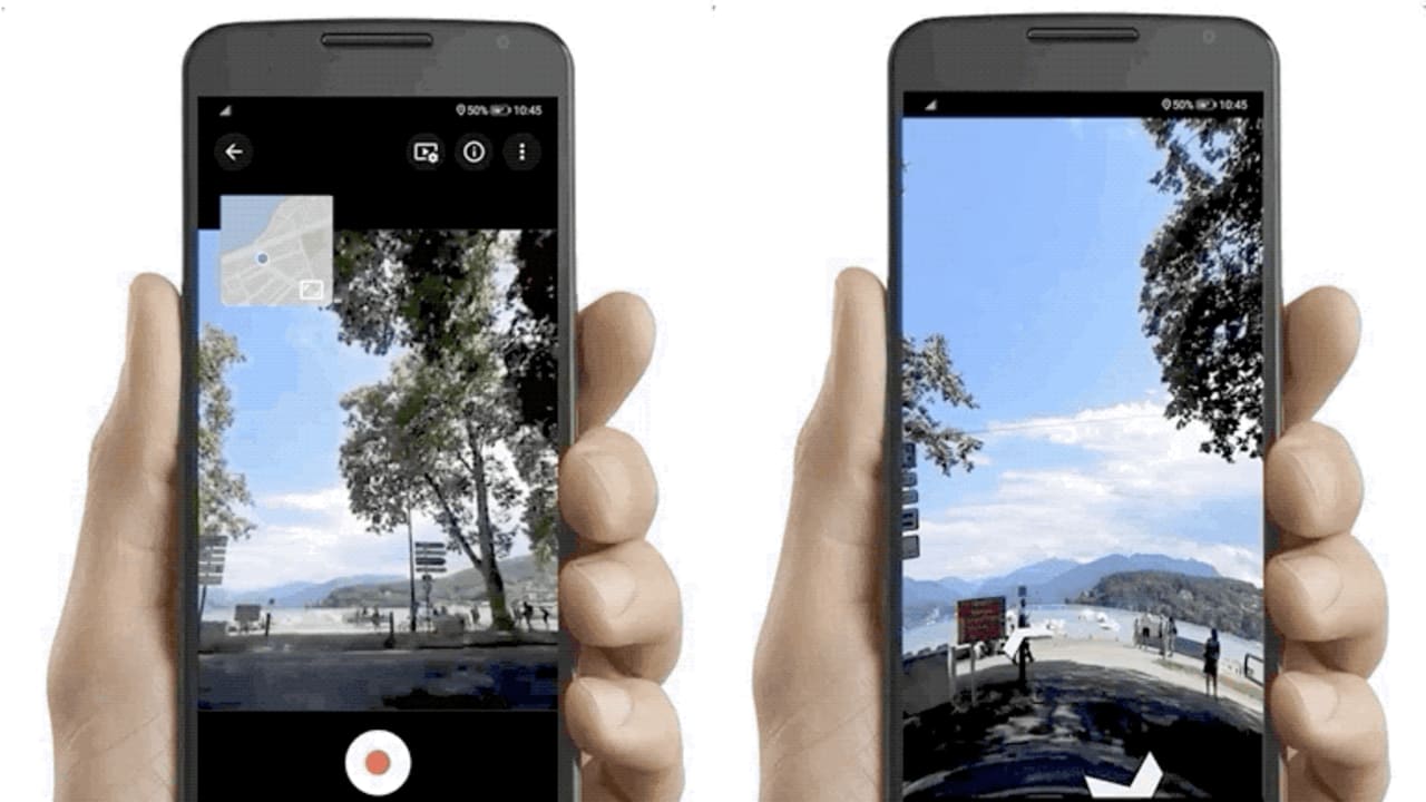
In the very near future you’ll be seeing photos shot on smartphones woven into Google Maps’ Street View. Until now, the street-level imagery in Street View has been shot mainly by expensive cameras mounted to the top of vehicles deployed by Google itself. Now some of that job will be outsourced to Android phone users who will use the Street View app to upload their own photos of streets and places. Google says that this will not only allow Street View to keep its imagery of changing neighborhoods more current but also extend its gaze to places it’s never been before, such as streets and roads in rural areas and in developing countries. To weave the user images into a continuous flow, Street View-style, Google says it’ll call on the same software it uses to stitch together the street-level imagery shot by its own car-cams. The software also blurs faces and license plates and places images in the appropriate place on Google Maps. If users capture business storefronts, those can be added to Google Maps along with their name and address, Google Maps product manager Stafford Marquardt tells me. The owner of the business might later come along and claim the listing and perhaps add more information, such as hours of operation, website, and phone number. Previously, Google allowed users in some places to submit Street View imagery shot using rotating cameras mounted to their own vehicles. (Yes, people really do this .) And users have been able to submit single-place photos that are viewable within Maps. But now is the first time Google will accept Street View images shot on smartphones. To submit imagery, you’ll need an Android phone that supports Google’s ARCore augmented reality framework , Marquardt says. The ARCore integration allows a phone to send data from its various sensors—such as the accelerometer and gyroscope—along with the Street View images to help orient them correctly within a place on the map. Google says it will gradually roll out the ability to capture and upload images through the Street View map. It’s already made the feature available to a small percentage of Maps app users in Austin and Toronto and is turning it on for users in New York City Thursday. The camerawork of these contributors will gradually become visible within the Street View app and within Maps on the desktop.
Read the original here:
Google wants you to help capture Street View’s next 10 million miles