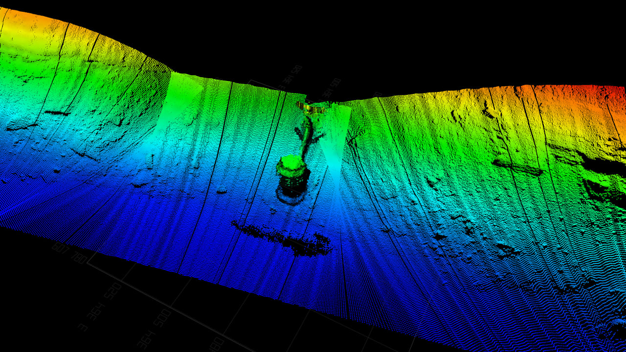
In 2005, Joe Wolfel and Judson Kauffman were a year into their Navy Seal careers when they received a briefing on the USS San Francisco , a nuclear-powered submarine that crashed into an undersea mountain, in large part due to uncharted waters. Joe Wolfel (left) and Judson Kauffman [Photo: courtesy of Terradepth] “The Navy really doesn’t have charts or maps of very much of the seafloor at all,” Kauffman says. Even now, 80% of the ocean remains unmapped, according to the National Oceanic and Atmospheric Administration . “That was the first time that either one of us understood the level of ignorance that exists around this subsea world, so that kind of planted a seed.” Still, their scheme for hurdling that challenge wouldn’t germinate for another dozen years, after the pair parlayed their military experience into a business consultancy and began noting the burgeoning array of space exploration robotics. “One day we looked at each other and said, ‘Why isn’t anybody taking this technology—autonomy, AI, and machine learning—and finding a way to map the ocean?’ ” Kauffman says. “There’s a whole lot of room for modern technology to come in and disrupt the world of ocean exploration and the industry of ocean surveys.” [Image: courtesy of Terradepth] That vision has since blossomed into Austin-based Terradepth , a data service company that has developed a new type of robotic submarine to autonomously map the ocean and its varied environments. [Photo: courtesy of Terradepth] The 30-foot-long submersible uses a camera and sensor suite to collect data, then employs machine learning to process it, discern what’s important, and reprogram itself to return to a location and test for additional information—all without human intervention. The system relies on edge computing, which can analyze information and solve problems at the data source in near real time. The team successfully ran the submarine through its first on-site paces in nearby Lake Travis earlier this month, paving the way for more robust testing in the Gulf of Mexico within three weeks and the Florida coast after that. Along with a camera, the submarine utilizes two types of sonar as well as depth, navigational, temperature, and geolocation instruments. It can dive to nearly 20,000 feet, the depth of 98% of the ocean
Read the original post:
2 former Navy Seals are using robot submarines to build ‘Google Earth’ for the ocean